Recent Posts
- March, 2026
- February, 2026
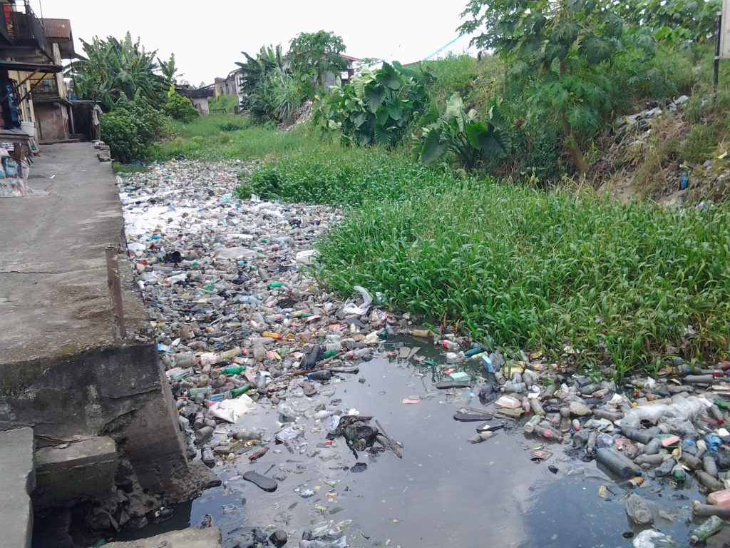
Why Nigerian Drainage Systems Fail: Solid Waste Blockages & Engineering Solutions
- January, 2026
- December, 2025
Maintaining Quality Control in Stormwater Drainage Projects in Remote Nigerian Locations
- November, 2025
Categories
- Case Studies
- Construction Law
- Construction Technology
- Consultancy and Advisory Services
- Engineering Design and Simulation
- Engineering Surveys
- Environmental
- Feasibility and Economic Studies
- Industry News and Trends
- Innovation and Research
- Mechanical, Electrical, and Plumbing (MEP)
- Project Supervision and Management
- Project Valuation and Cost Control
- Safety and Regulations
- Training and Education
- Uncategorised
- more