Tag Archives: drainageholes

FINDINGS AND OBSERVATIONS IN FLOOD-PRONE AREAS OF DELTA STATE -1 by Engr. John Cee Onwualu (FNSE)

Studies were conducted over the entire flood-prone areas, valleys, natural watercourses, swamps, and rivers, including existing drains in Asaba, Warri, Effurun, and environs. The studies showed that:

i. There were no previous records of survey data and maps for the cities;

ii. While Warri had an old Master plan, Asaba had none;

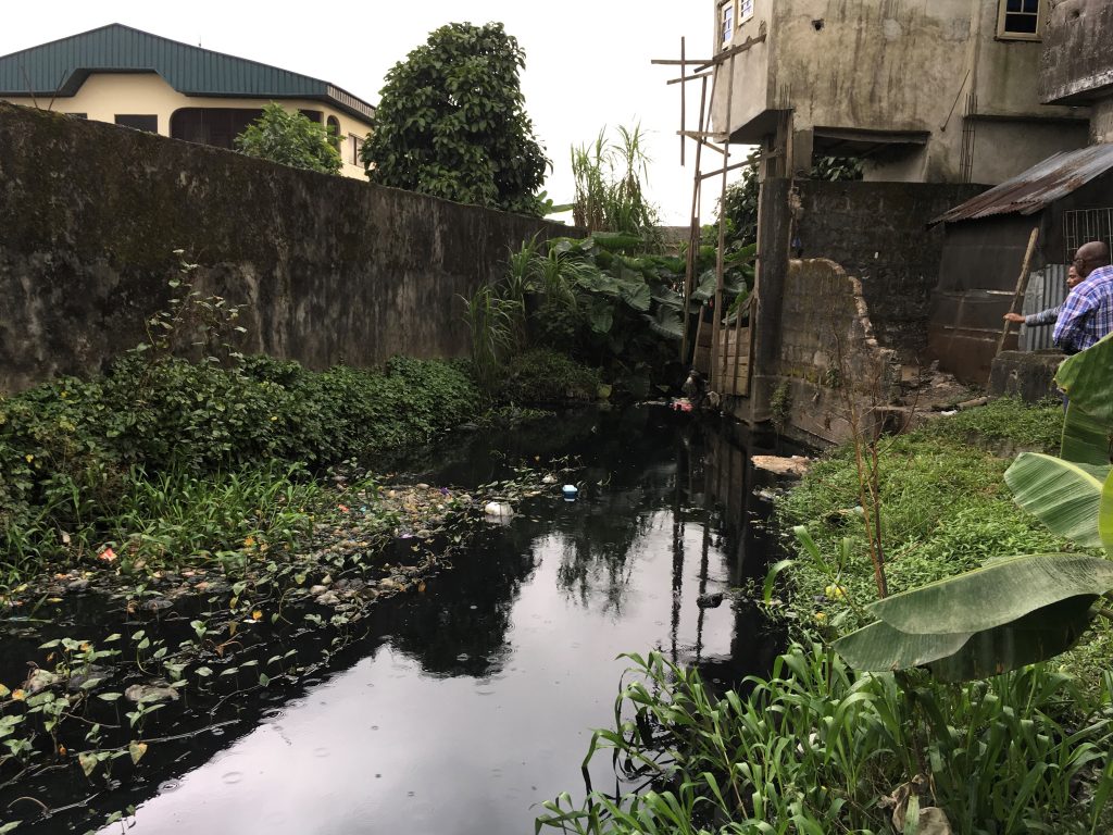
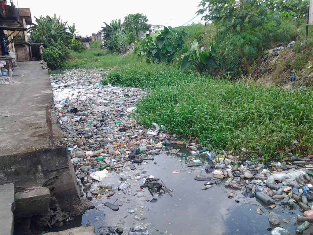
iii. A large part of the flooding noticed in Asaba, Warri, Effurun and environs could be attributed to blocked drainage channels with waste materials (decomposable and non-decomposable), silts, overgrown weeds etc. The result is that the flow discharge into the drainage channels is disturbed and hence could not be evacuated from the environment;

iv. Most of the existing drains do not have discharge points as they were constructed without design specifications;

v. The rapid urban development in Asaba, Warri, Effurun, and environs have caused the stripping of the vegetative covering, leaving the soil surface exposed to the damaging effect of erosion. This has created serious silt deposit inside the existing channels, thereby reducing the design flow volume;

vi. Serious flooding noticed in many parts of Asaba, Warri, Effurun, and environs is a result of non-functioning drains that have been filled with silt deposits over the years thereby reducing the original flow section as designed;

vii. Most developers have encroached into the streets’ right-of-way and in some cases completely blocked the natural waterways. These are more noticeable in Okpanam area of the Capital Territory, Effurun, Warri GRAs and Ugbogboro creek in Ugborikoko, Sokoh Estate, Bendel Estate, Lower and Upper Erejuwa;

viii. All the natural watercourses are overgrown with weeds and a large amount of silt deposits, and in some cases have become refuse dumps, especially in Tori Creek, Crawford Creek, and Ugbogboro Creek/River;

Read about more of the observations and findings in my article, FINDINGS AND OBSERVATIONS IN FLOOD-PRONE AREAS OF DELTA STATE -2

Hydrological Basins in Delta State, Nigeria by Engr. John Cee Onwualu (FNSE)

Studies were conducted to identify all the flood-prone areas in Asaba, Warri, Effurun, and environs, all in Delta State of Nigeria.

These studies were to help develop efficient and effective flood water control measures that would safely convey run-off from the streets to the natural watercourses and rivers without loss of lives and property.

The major objectives of the study were:

1. To identify the root cause(s) of flooding in Asaba, Warri, Effurun, and environs.
2. To provide primary drainage channels that would incorporate the existing and new secondary and tertiary drains for efficient and effective evacuation of the floodwater from the environment to the natural watercourses.
3. To make the natural watercourses efficient by desilting and removal of obstructions on flow paths.

Asaba, Warri, Effurun, and environs are viewed as hydrological basins that drain to the major Rivers (Niger and Warri) within their localities. These basins were broken into catchments using existing road networks for delineation as boundaries.

In the case of Asaba, the absence of water bodies limited the design approach to nature-based types, such as valleys, streams, and rivers that are tributaries to the River Niger.

But in the case of Warri and Effurun, the catchment areas contain lots of water bodies (swamps) and natural watercourses, which serve as the receiving basins for floodwater evacuation from the environment.

The delineation with existing road networks into catchment areas made the application of the Rational Formula and the Hydrological Analysis convenient.

Studies were conducted over the entire flood-prone areas, valleys, natural watercourses, swamps, and rivers, including existing drains in Asaba, Warri, Effurun, and environs.

The outcome of these studies is properly captured in my next post, Findings and Observations in Flood-prone Areas of Delta State, Nigeria.

Oil Hubs in Delta State, Nigeria by Engr. John Cee Onwualu

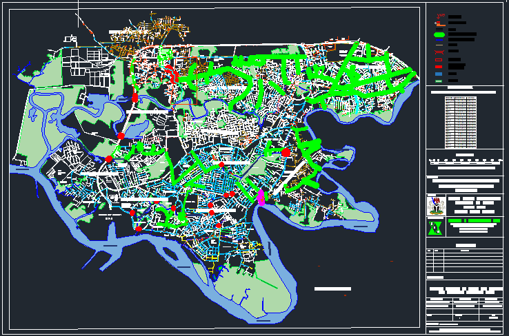
Warri and Effurun as shown in the figure, are located on Latitudes 5o27’ N and 5o36’ N and Longitudes 5o40’ E and 5o48’ E. They sit on the bank of Warri River which joined Forcados, and Escravos Rivers through Jones Creek in the lower Niger Delta Region to the Atlantic Ocean.

Studies have shown this region to have moderate rainfall and humidity from May to October. Experience has shown it to have a short dry season from December to March, making construction activities to be at their peak during these months. The natural vegetation predominant in this region is a rain forest with swamp forest in some areas.

Warri is one of the oldest cities found within the lower Niger of Nigeria. The city is described as a low-lying plain that consists mainly of unconsolidated sediments of Quaternary age. The sediments are partly of marine and fluvial origin.

It is one of the oil hubs in Delta State with Udu and Uvwie kingdoms having been integrated into the larger cosmopolitan Warri. It originally, comprised three ethnic groups of Urhobo, Itsekiri, and Ijaw people.