Understanding Invert Levels in Flood-Control Engineering: A Case Study of Asaba’s Summit Road
Understanding Invert Levels in Flood-Control Engineering: A Case Study of Asaba’s Summit Road
By John Cee Onwualu (FNSE, FNICE, FNIWE, P.E., R.ENG, MASCE)
Urban flooding is a persistent challenge in rapidly urbanising regions, threatening infrastructure, public health, and economic stability. For engineers and urban planners, designing effective flood-control systems requires a good understanding of hydraulic principles, with invert levels serving as a cornerstone of this discipline.
This article delves into the critical role of invert levels in gravity-fed drainage systems, breaking down their computation methods, their impact on hydraulic efficiency, and their application in a real-world case: the Summit Road Stormwater Drainage Project in Asaba, Delta State, Nigeria.
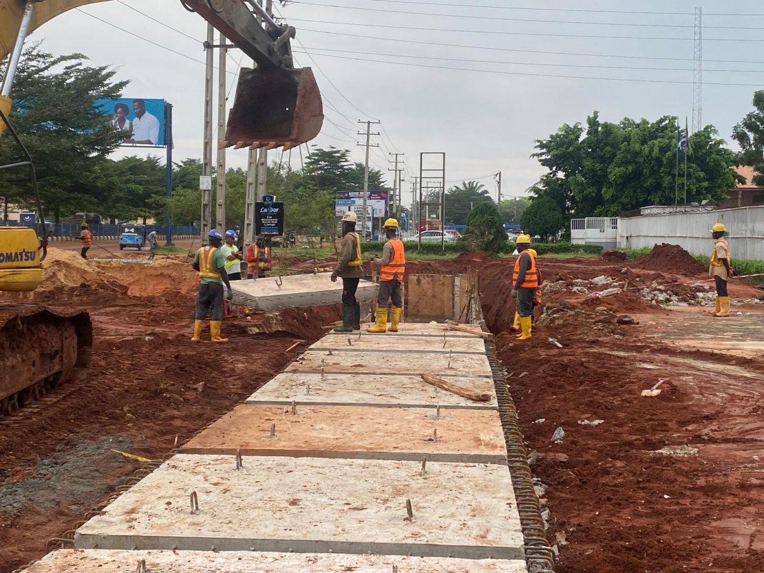
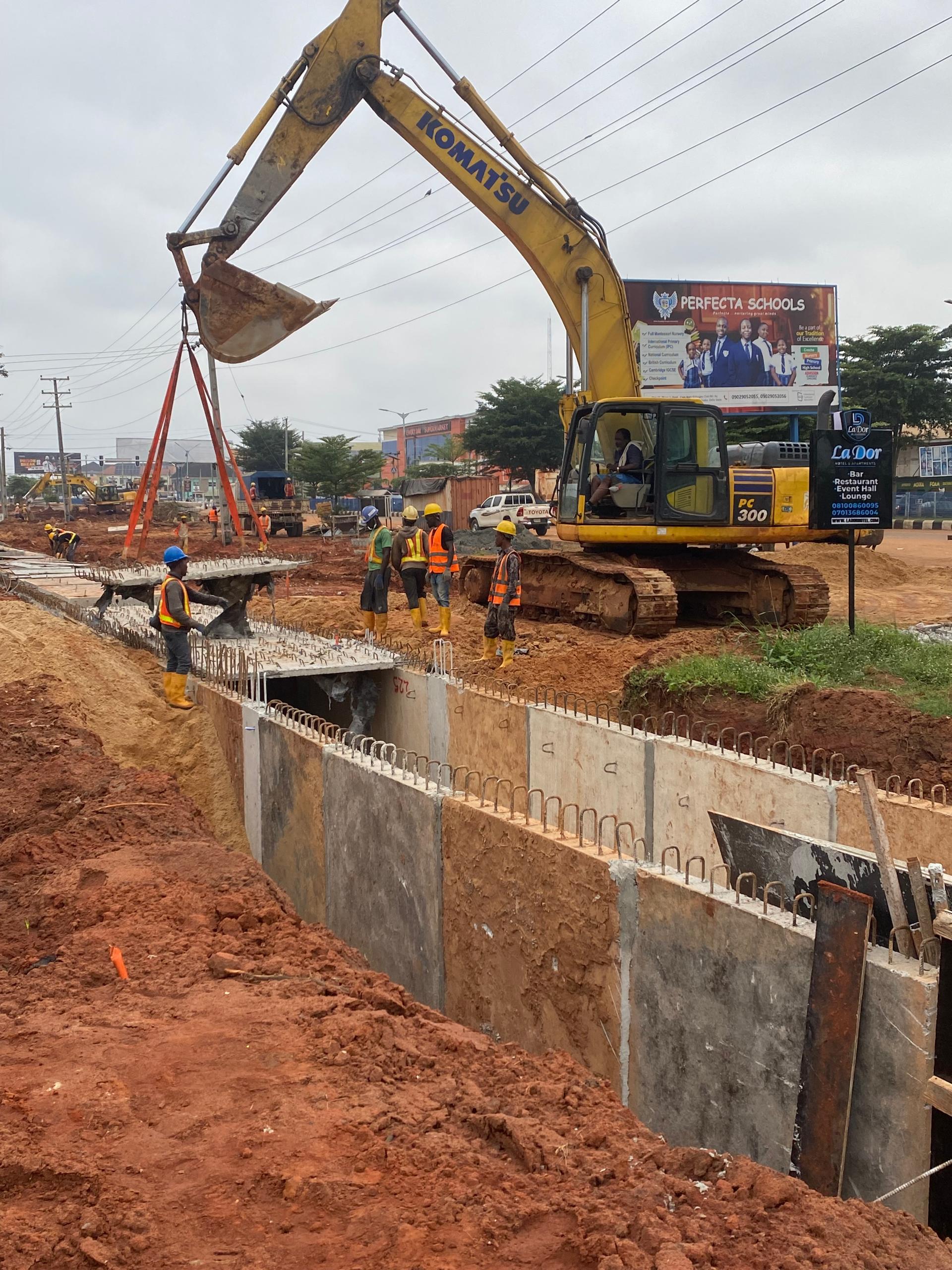
Concrete cast of precast base at CH 0+200
What Are Invert Levels?
Invert levels are a foundational concept in civil and hydraulic engineering. Simply defined, an invert level is the elevation of the lowest interior point of a pipe or channel, typically measured relative to a geographic datum (e.g., sea level). This measurement is important because it forms the baseline for calculating pipe slopes in gravity-driven systems. Properly designed invert levels ensure that wastewater and stormwater flow smoothly, maintaining self-cleansing velocities that prevent sedimentation and blockages.
In gravity-fed systems, where water flows due to elevation differences rather than mechanical pumps, invert levels dictate the slope of conduits. A well-sloped pipe keeps water moving at a velocity sufficient to carry suspended solids and debris—critical for preventing clogs. If the slope is too flat, sediment builds up; if too steep, erosion and structural stress become risks.
Invert Level Computations: The Math Behind the Design
Calculating invert levels is a straightforward yet precise process. The basic formula is:
Invert Level = Ground Level (Reduced Level, RL) – Pipe Depth to Invert
For example, if the ground level (the top of the pipe) is recorded at 102.50 meters, and the pipe depth to the invert is 1.20 meters, the invert level would be:
102.50 m – 1.20 m = 101.30 m
This value then informs the design of the pipe’s slope. Engineers typically specify gradients between 1:40 and 1:100, meaning that for every 40 to 100 meters of pipe length, the invert drops by 1 meter. This range ensures a balance between sufficient flow velocity and structural integrity.
Modern computational tools like Storm Water Management Model (SWMM) integrate invert level calculations with geographic data. These tools use Digital Elevation Models (DEMs), subcatchment slopes, peak flow rates, and rainfall intensity to simulate hydraulic behaviour. By modelling these variables, engineers can optimise junction inverts, conduit dimensions, and flow velocities, ensuring that systems handle both regular and extreme weather events.
The Role of Invert Levels in Hydraulic Flow Efficiency
Invert levels are not just numbers on a blueprint—they are the linchpin of functional hydraulic systems. When pipelines connect at junctions, matching invert levels is essential to prevent backflow, stagnant pools, and disruptions. A mismatch can lead to flow reversal during high discharge events, exacerbating flooding rather than mitigating it.
Ensuring Self-Cleansing Velocities
The slope determined by invert differences directly impacts the velocity of flow. For effective sediment transport, pipelines must maintain a minimum velocity of 0.6–0.75 m/s. Invert levels are adjusted to meet this threshold, ensuring that debris and solids are flushed through the system rather than accumulating as blockages.
Stilling Basins and Energy Dissipation
In more complex systems, such as those involving stilling basins for energy dissipation, invert levels are calculated with advanced hydraulic modelling. For example, the elevation of a stilling basin must be optimised relative to upstream and downstream water levels, along with the Froude number (a dimensionless ratio of inertial to gravitational forces). This ensures that hydraulic jumps—sudden transitions from supercritical to subcritical flow—are controlled, minimising erosion and structural damage.
Case Study: Asaba’s Summit Road Stormwater Project
The Summit Road Stormwater Drainage Project in Asaba, Delta State, exemplifies how invert level design and modern geospatial tools can address urban flooding.
Stretching 6.5 kilometres, the project connects DBS Road, Shoprite axis, and Summit Road, channelling stormwater to the Amilimocha Stream and, indirectly, to the Niger River. This system is critical in combating perennial flooding across the city, which has damaged infrastructure and disrupted daily life.
Geospatial and Hydraulic Integration
The project leverages GIS (Geographic Information Systems) and DEM (Digital Elevation Models) to model flow patterns and optimise invert transitions. Digital Ground Penetrating Radar (DGPS)-validated orthometric heights are used, with elevations ranging from 63.63 to 63.81 meters in key junctions. These data show an average deviation of -0.06 meters from DEMs, a subtle but significant difference when designing precise gradients.
Using SWMM, engineers simulated subcatchment delineations, flow accumulation, and invert computations. This allowed them to determine junction elevations and ensure that the system’s 1:40–1:100 gradient ranges were feasible. The DEM also revealed elevation sinks—low-lying areas prone to water retention—which were filled to improve natural runoff routes toward the Niger River.
Challenges and Innovations
One of the project’s challenges is the lack of publicly available data on specific invert transitions. However, the use of BIM (Building Information Modeling) and GIS integration has enabled precise planning of pipe interconnectivity. By processing elevation ranges of 42–424 meters (noted in the DEM), the project adapts to Asaba’s varied topography, ensuring that invert level transitions are smooth and efficient.
This approach not only addresses current flooding but also future-proofs the system against climate change–induced rainfall extremes.
Why This Matters: Invert Levels as a Flood-Control Foundation
The Summit Road project underscores the importance of invert levels in every stage of flood-control design: from initial computation to on-ground implementation. Invert levels:
- Ensure gravity-driven flow by dictating pipe slopes.
- Prevent sedimentation through velocity optimisation.
- Enable smooth transitions between conduits and junctions.
- Support resilience against extreme weather events.
Invert level design is no longer a manual calculation but a data-driven science. The integration of GIS, DEMs, and software like SWMM allows engineers to model complex urban environments with precision, minimising risks and enhancing sustainability.
Conclusion: From Theory to Practice in Asaba
Urban flooding is a symptom of misaligned infrastructure and unoptimized hydraulic systems. Invert levels, though often overlooked, are the silent architects of urban drainage. The Summit Road project in Asaba demonstrates how meticulous invert design, combined with geospatial and computational tools, can transform flood-prone areas into efficient, sustainable environments.
As cities worldwide grapple with the dual challenges of urbanisation and climate change, the lessons from Asaba serve as a blueprint. By grounding flood-control strategies in precise invert level computations and leveraging cutting-edge technology, urban planners can safeguard communities while fostering resilience.
For engineers and policymakers, the message is clear: invert levels are not just technical parameters—they are the bedrock of hydraulic efficiency and urban safety.

References
1. (https://www.vapar.co/invert-level-of-pipe/)
2. https://www.youtube.com/watch?v=yUgLv71AYxw)
3. (https://gjeta.com/sites/default/files/GJETA-2024-0030.pdf)
4. (https://www.scribd.com/document/438199185/Invert-level)
5. (https://www.scribd.com/document/456385549/determination-the-invert-level-of-a-stilling-basin-to-control-hydraulic-jump-1)
6. (https://guardian.ng/features/infrastructure-revolution-how-oborevworis-projects-are-reshaping-delta/)
7. (https://www.facebook.com/deltafirstmediadfm/videos/update-the-work-on-the-stormwater-drainage-linking-dbs-road-shoprite-axis-and-su/3279000955611563/)
8. (https://grokipedia.com/page/Invert_level)
9. (https://www.facebook.com/DSGovernment/posts/construction-work-is-progressing-on-the-stormwater-drainage-project-along-summit/1102001662110947/)
10. (https://www.facebook.com/DSGovernment/videos/the-work-on-the-stormwater-drainage-linking-dbs-road-shoprite-axis-and-summit-ro/1142782107515715/)
11.(https://www.sfwmd.gov/sites/default/files/documents/atlas_of_flow_computation_at_sfwmd_hydraulic_structures.pdf)
12. (https://www.facebook.com/groups/umehneeds/posts/24858290850476936/)
13. (https://www.facebook.com/DSGovernment/posts/the-work-on-the-stormwater-drainage-linking-dbs-road-shoprite-axis-and-summit-ro/1114477174196729/)
14. (https://www.scribd.com/document/755969183/Updated-Benin-Asaba-Preliminary-Report)
15. (https://www.instagram.com/reel/DPOlggCDP6v/)
16.(https://documents1.worldbank.org/curated/en/208471467992500413/txt/E4839-V8-EA-P133071-Asaba-ESMP-Box393226B-PUBLIC-Disclosed-10-9-2015.txt)
17. (https://www.instagram.com/p/DOoKf6QjAd0/)
18. (https://www.facebook.com/100070816395269/posts/ongoing-storm-water-drainage-project-along-summit-road-asaba-by-delta-state-gove/812920787745127/)