Tributaries to the River Niger Within Asaba, DELTA STATE, NIGERIA by engr. john cee onwualu
Asaba is situated at the western bank of River Niger, overlooking the point where the Anambra River flows into it. It is sandwiched between Anwai in the North, Issele-Azagba in the West, Ibusa in the South, and River Niger in the East.
The eastern axis of the territory is marked with low relief that falls to about 22 metres above mean sea level, while the western axis shows the features of high relief that rises to about 175 metres above mean sea level.
The 2006 census shows that Asaba had a population of 149,603. Asaba has a large population of Igbo-speaking people, but her position as Delta State Capital has brought her a cosmopolitan population drawn from other ethnic nationalities such as Urhobo, Isoko, Ijaw, Itsekiri, Hausa and Yoruba people, etc.
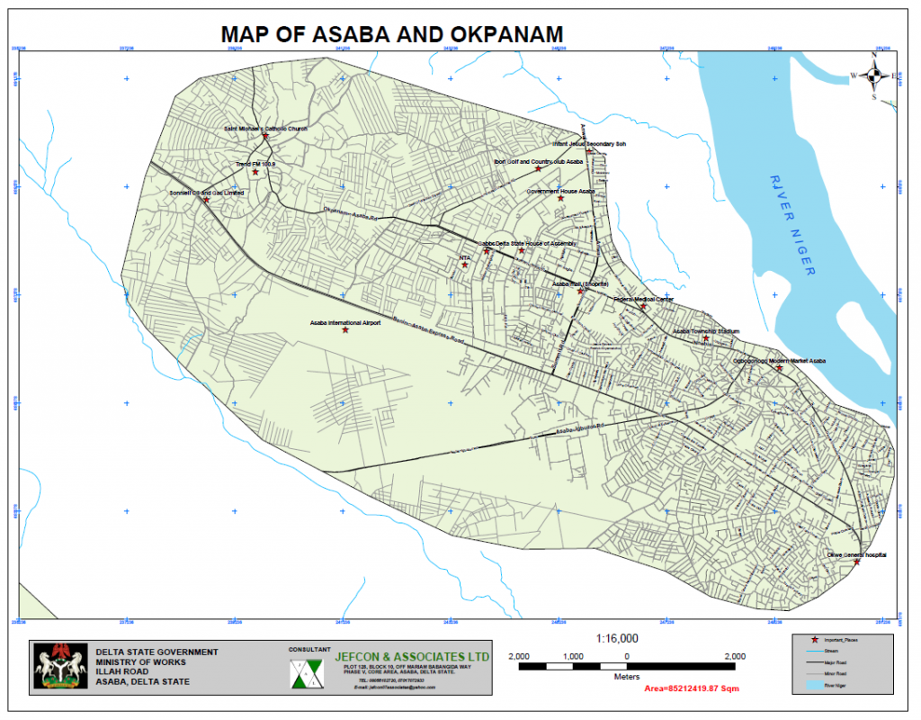
Its geographical location lies between latitude 060 15’ 17.84” N and 060 09’ 38.49” N and longitude 060 36’ 23.48” and 060 45’ 13.35” E as shown in Figure 1. Asaba lies in a plain between 88m to 41m, and about sixty-five percent (65%) within this plain is sitting in a flat terrain, which is between 44m – 41m.
There are some nature-based drainage routes that are tributaries to River Niger within Asaba, such as Iyi-Abi that is in the South, and Anwai River in the North-East. The project section covers only an area of about 8,521.24 hectares (85.212-sqkm).
Pingback:Tributaries to the River Niger Within Asaba – KINGS VIEW BOOKS