Preventing Stormwater Pollution: Implementing Effective QC for Drainage Systems in Nigeria By John Cee Onwualu (FNSE, FNICE, FNIWE, P.E., R.ENG, MASCE)
Preventing Stormwater Pollution: Implementing Effective QC for Drainage Systems in Nigeria Stormwater, the water that runs off impervious surfaces during rainfall, is a critical element in urban environments. While seemingly benign, its journey through our cities can transform it into a potent source of pollution, significantly impacting Nigeria’s ecosystems and public health. Effective quality control (QC) for drainage […]

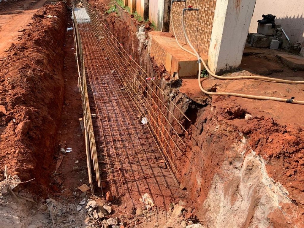
Understanding Geotechnical Considerations for Stormwater Drainage QC in Nigeria By John Cee Onwualu (FNSE, FNICE, FNIWE, P.E., R.ENG, MASCE)
Understanding Geotechnical Considerations for Stormwater Drainage QC in Nigeria In civil engineering, the success of stormwater drainage systems depends heavily on geotechnical considerations. The interplay between soil properties and ground conditions directly impacts the quality, durability, and long-term functionality of these systems. In Nigeria, with its diverse soil profiles and environmental challenges, incorporating geotechnical insights […]
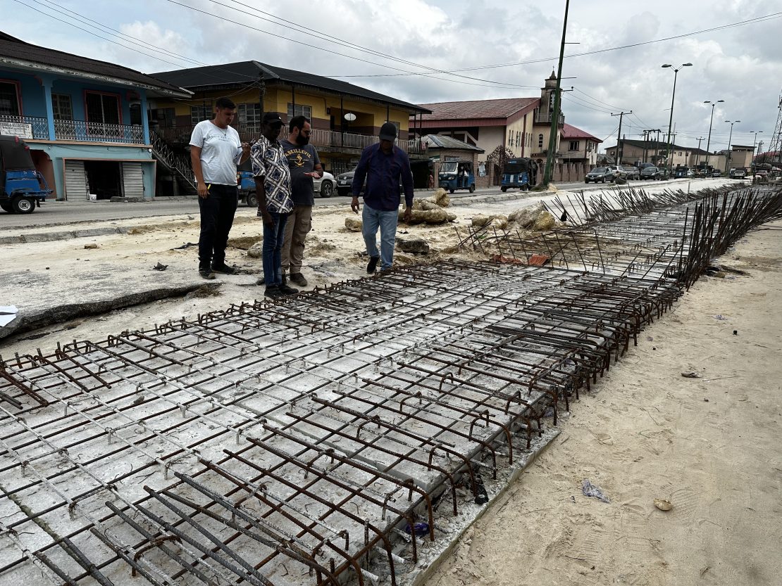
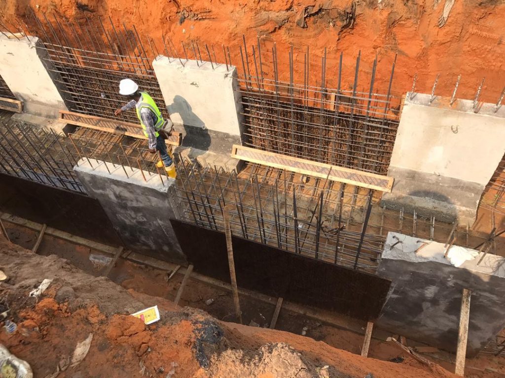
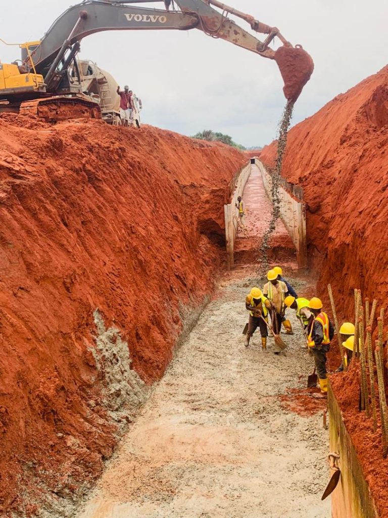
Best Practices for Concrete Work in Stormwater Drainage: Quality Control for Durability in Nigerian Climates By John Cee Onwualu (FNSE, FNICE, FNIWE, P.E., R.ENG, MASCE)
Best Practices for Concrete Work in Stormwater Drainage: Quality Control for Durability in Nigerian Climates Concrete forms the backbone of stormwater drainage systems, providing the strength and durability needed to withstand environmental stresses. In Nigeria, where heavy rainfall and fluctuating temperatures often challenge infrastructure, ensuring the quality and longevity of concrete used in stormwater systems […]
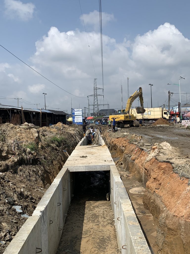
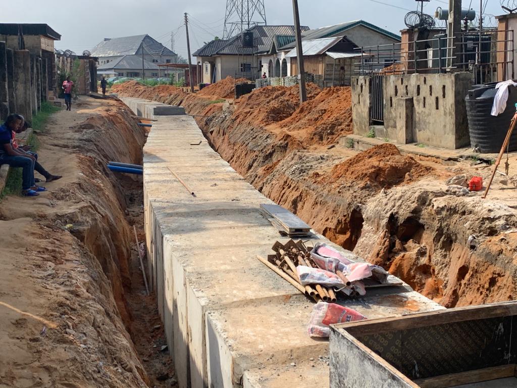
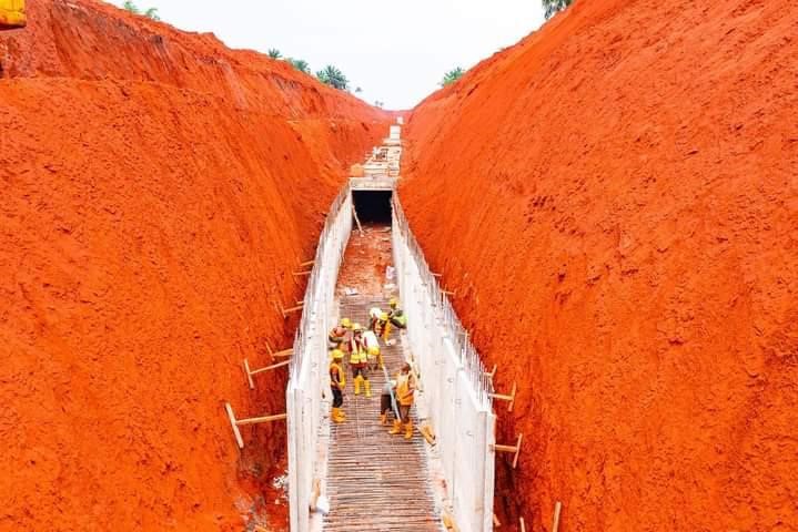
Ensuring Stormwater Drainage System Efficiency: Quality Control Measures in Nigerian Construction Projects by John Cee Onwualu (FNSE, FNICE, FNIWE, P.E., R.ENG, MASCE)
Ensuring Stormwater Drainage System Efficiency: Quality Control Measures in Nigerian Construction Projects In Nigeria, the increasing frequency of flooding and urban waterlogging underscores the critical need for effective stormwater drainage systems. These systems are essential for managing rainwater runoff, protecting infrastructure, and safeguarding public health. This article delves into the importance of quality control (QC) […]
Challenges of Storm Water Management in Urban Areas of Nigeria: A Critical Analysis
This paper critically analyzes the various challenges associated with stormwater management in urban areas of Nigeria. It explores the interconnected nature of these challenges, encompassing inadequate infrastructure, rapid population growth, poor urban planning, and a lack of financial and institutional capacity.
Evaluating the Success and Effectiveness of Existing Drainage Systems for Managing Rainwater Runoff in Nigeria
Discover the effectiveness of existing drainage systems in Nigeria for managing rainwater runoff. This article explores the successes, challenges, and areas for improvement in mitigating flooding and ensuring efficient water management in Nigeria.
Addressing Nigeria’s Water Pollution Crisis: The Role of Storm Water Management
By John Cee Onwualu (FNSE, FNICE, FNIWE, P.E., R.ENG) Understanding the Environmental Challenge Water Pollution: A Major Crisis in Nigeria Nigeria, the most populous country in Africa, is grappling with a severe environmental crisis – water pollution. Despite its wealth of water resources, including rivers, lakes, and underground aquifers, the nation struggles to provide its […]

The urgent need for sustainable stormwater management engineering practices
LECTURE PRESENTATION TO NIGERIAN INSTITUTE OF CIVIL ENGINEERS (NICE), ASABA CHAPTER, DELTA STATE, NIGERIA ON
THURSDAY, 2ND NOV. 2023

Examples of sustainable storm water management practices in urban areas
Excerpt from, “LECTURE PRESENTATION TO NIGERIAN INSTITUTE OF CIVIL ENGINEERS (NICE), ASABA CHAPTER, DELTA STATE, NIGERIA ON
THURSDAY, 2ND NOV. 2023”
Challenges posed by traditional Stormwater Management Practices
Excerpt from a LECTURE PRESENTATION TO NIGERIAN INSTITUTE OF CIVIL ENGINEERS (NICE), ASABA CHAPTER, DELTA STATE, NIGERIA ON THURSDAY, 2ND NOV. 2023